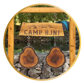

Below are tips for seven local hikes.
Always leave nature as you found it –
anything you bring with you (food, papers, bottles, trash)
should be taken back out for disposal.
1: Mesa Cave Hike
Distance from Camp Bjni Basecamp to Trailhead: 1 minute.
Excursion Duration: 45+ minutes roundtrip.
Level of Difficulty: Easy to Moderate.
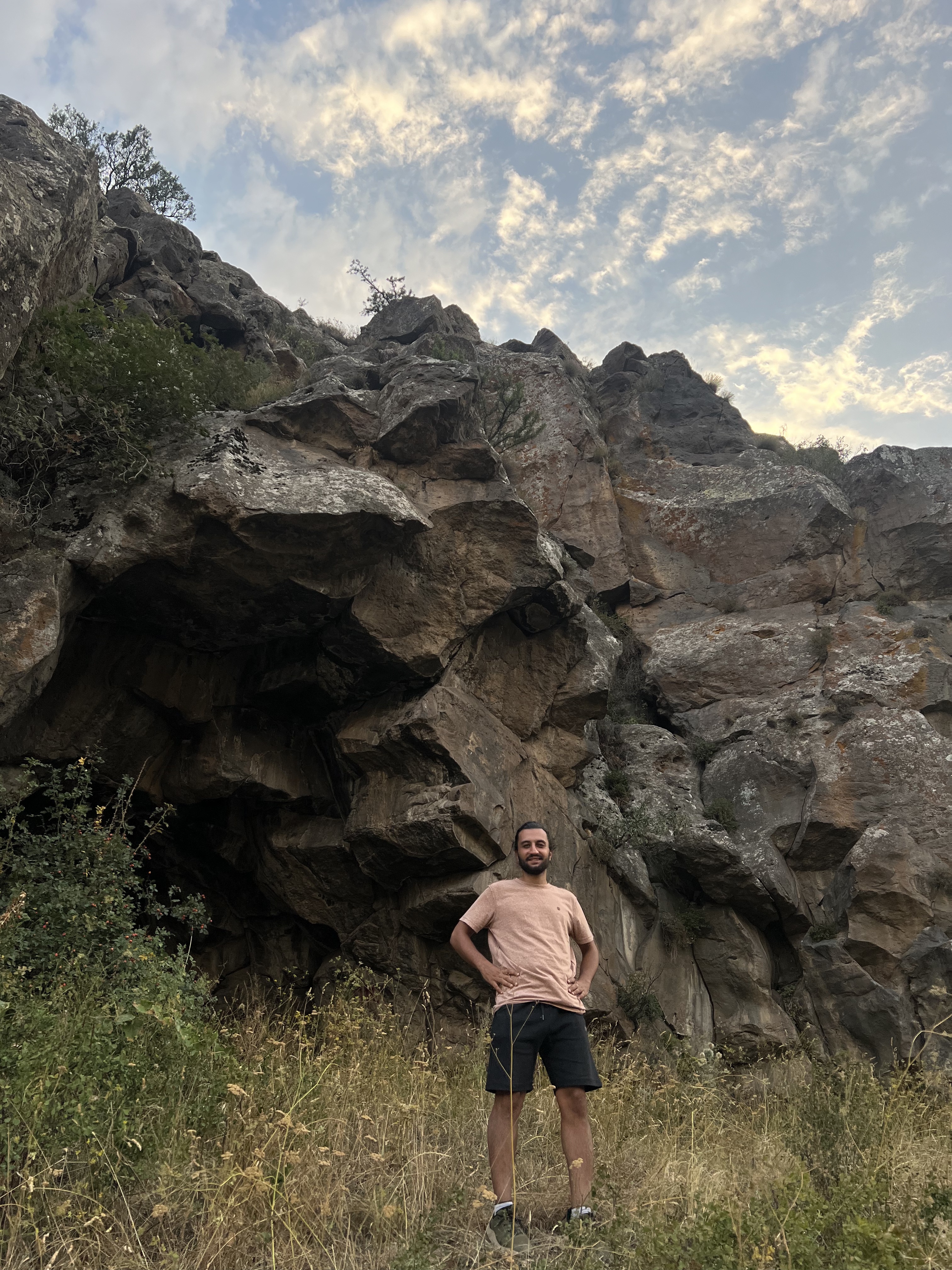
Directly above the Camp Bjni basecamp is a massive mesa. Climbing it requires long pants and long sleeve shirts as there are plenty of bramble bushes, thorny plants and sharp, moss-covered volcanic rocks. There are a few snaky and slightly beaten paths to the top. From basecamp, walk beyond our front gates toward the river. Follow the narrow path on the other side of our fence. When the fence opens up to pasture, start walking upward in a snaking motion. If you aim for the center of the mesa, you will be rewarded with a large cave that offers beautiful high elevation views of the mountains, vacation cottages and wandering cows and sheep in the direct vicinity. Local lore states that during thunderstorms, the cave houses hundreds of sheep. After visiting the site, we can attest to this. The mesa cave is a fine place to enjoy scenic views, a packed lunch and even a well-deserved, shady nature nap.

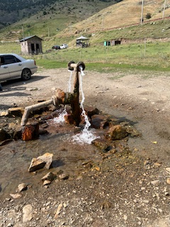
2: A Stroll to a Mineral Water Source
Walking Distance from Camp Bjni Basecamp: 15 minutes heading towards Bjni village.
Excursion Duration: Up to you.
Level of Difficulty: Easy.
Beyond Camp Bjni, walk along the main road towards Bjni village. Right away you will see a large stone house under construction on the left side of the road. As you approach the first big curve in the highway, take the descending path that leads to a metal gazebo. Continue walking down that path to a public mineral water spout beside the Hraztan River. Here you can drink the healthful waters, enjoy a packed lunch or wash your hands and feet as you rest by the picnic tables or River.
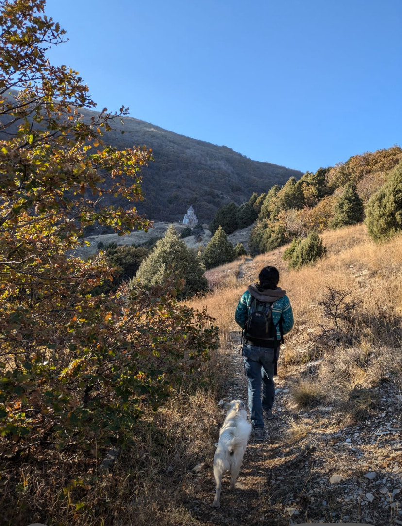
3: Mayravank Hike
Walking Distance From Camp Bjni Basecamp to Trailhead: 40 minutes.
Excursion Duration: 4 hours.
Level of Difficulty: Moderate to Difficult
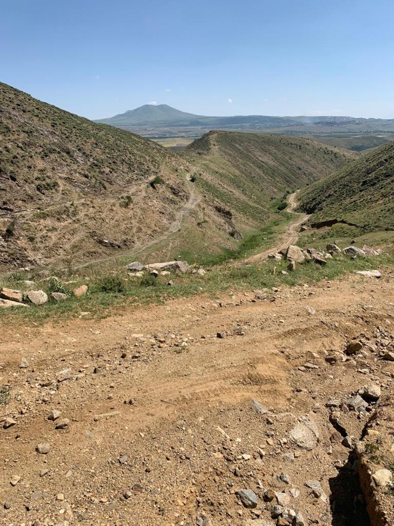
This magnificent site is in the village of Kaghtsi, next to the village of Solak, next to the village of Bjni. The trailhead is directly accessible from the main road of Bjni. This is an arduous but thoroughly exhilarating 6-mile hike. Visitors will traverse harsh vertical slopes and plod through prairies and forested areas. All offer breathtaking perspectives of the settlements below and the high Keghama mountain ranges including clear views of Mt. Ararat, Arakadz, Ara Ler, and the Hraztan Reservoir.
You will encounter indigenous plants such as spruce and catmint as well as shrubs such as aloj (hawthorne berry), arduj (juniper berry), and masur (rose hips). Mayravank has an elevation of 2000 meters above sea level. To navigate the high-altitude change, pack a balaklava (face mask), a walking stick, drinking water and take rest breaks.
The monastery of Mayravank was constructed in the 7th century but today stands in ruins. Only the 11-12th c church (Mayr Asdvadzadzin, aka Holy Mother of God) remains on the grounds. This church stands as a beacon from a great distance, dramatically perched on a cliff surrounded by forested mountains. It was reconstructed in 2023. There are several khatchkars, the ruins, the “Eternal Spring” of mountain water that gushes nearby, and a clergy house. The site is a protected historic & cultural monument.
Hikers can expect jagged loose rocks and very steep unsteady terrain for the return on the same trail. If the sun is setting during the completion of this hike, we recommend hiking down the rough, steep road which only sturdy vehicles such as jeeps and four-wheel drives can manage.
During the Holy Ascension every August, when Armenians celebrate Mother Mary’s ascent to Heaven, locals make the pilgrimage to this feast’s namesake sanctuary. They prepare harissa, bring grapes to be blessed, pray, sing and sleep there overnight.
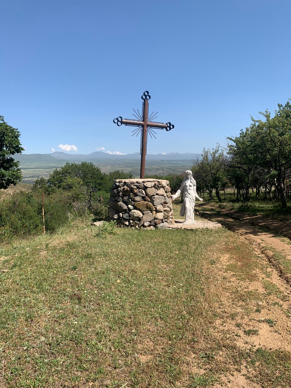
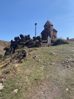
4: St. Minas Hike
Walking Distance From Camp Bjni Basecamp: 45 minutes by walking towards the center of Bjni village.
Excursion Duration: 4 hours roundtrip (45 minutes to site; 1.5 hour uphill hike; 45 minutes for picnic lunch and exploration; 45 minutes downhill hike; 45 minute walk to basecamp)
Level of Difficulty: Easy to Moderate
According to oral history, there are 300 chapels in Bjni. One of the most striking is St. Minas, situated on a rugged mountaintop in Bjni village. St. Minas was a Christian Egyptian eremite and martyr revered by the Orthodox Christian world. This chapel was renovated in 2016 under the patronage of the Manuk Movsesyan family of Bjni.
St. Minas is a spectacular mountaintop oasis, replete with chapel sanctuary and a sculpture park. There are also grilling pavilions and some antique rest huts. On this excursion, hikers will be rewarded with rough terrain that has a wild, bristly beauty. The way up is an irregular, ditch-laden road that only four-wheel drive trucks, committed pilgrims and hikers can navigate. A babbling stream runs parallel with most of the road and there are copious butterflies of every color and stripe as well as birds, ducks, lizards and crickets. The high views of the Kotayk region, visible along the hike, are magnificent.
Pack a lunch to enjoy once you reach the top. You can obtain provisions from Mrs. Zemfira at the “Tonradun” and grocery store directly off the main road in the center of the Bjni hamlet. To reach the St. Minas trailhead from the Tonradun, take the road just to the left of the building that leads up to the Toumanyan public school. Continue past the school on that road until you reach a fork. Make a slight right at the corner where a store sign reads, in Armenian, “Հագուստ, պիժամա, սպիտակեղեն, բարձեր, վերմակներ” (clothes, pajamas, linens, pillows, blankets). Pass the building and make a slight left to continue on the winding uphill path. That path will take you to St. Minas.
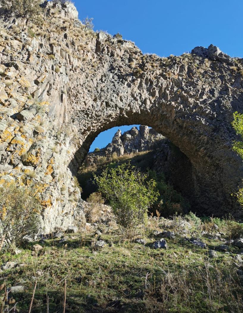
5: Dzag Kar Hike (Hole in the Rock)
Distance from Camp Bjni to Trailhead: 5 minutes.
Excursion Duration: 5 Hours Roundtrip.
Level of Difficulty: Difficult.
Ծակ քար (Hole in the stone) is a geological nature monument in central Bjni, which is an entirely natural arch formation of stone. It’s registered among the official state monuments of nature by the Ministry of Environment of the Republic of Armenia.
Dzag Kar is said to have supernatural properties and that s/he who walks through this tunnel will have his/her wishes granted. In the vicinity, there is an intermittently running cold spring called Gatnaghbyur, the waters of which, according to popular belief, increases the milk of lactating women and cures cattle of disease.
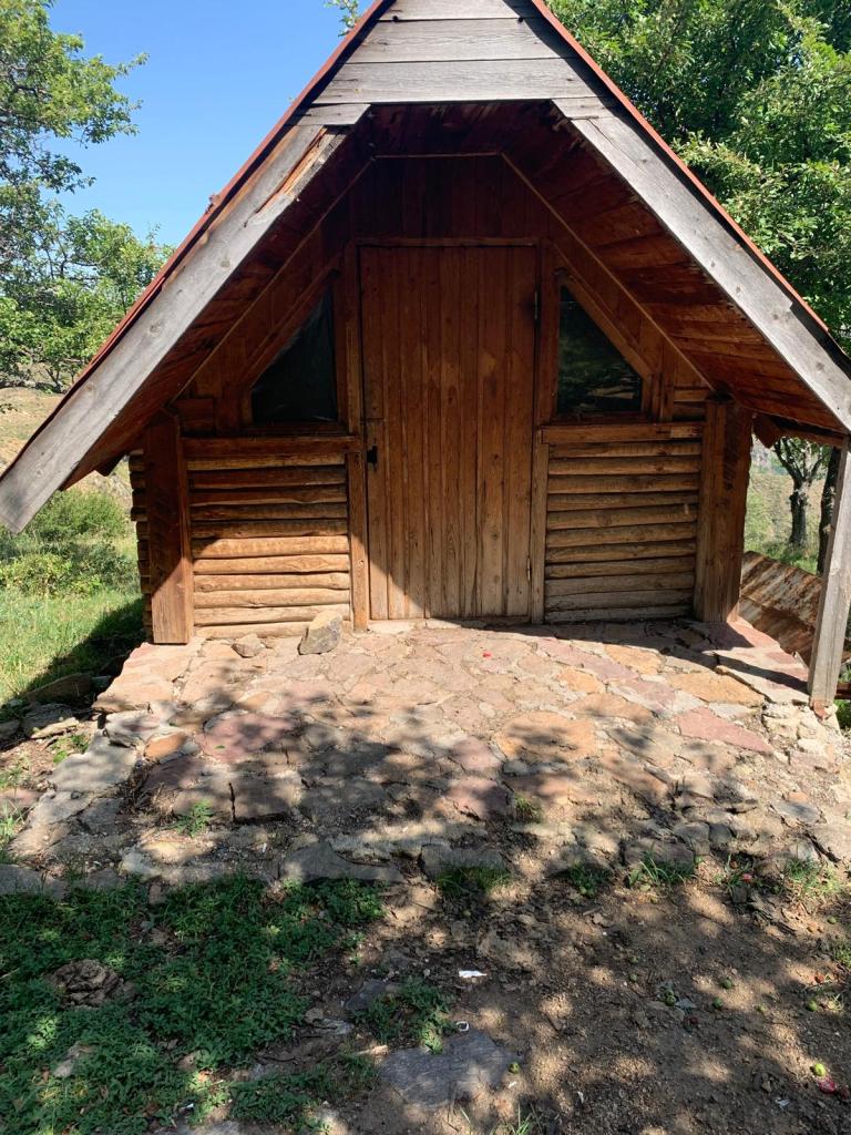
The hike begins outside the “Sev Khrjit” or “black cottage” Camp Bjni gathering house. An upward climb follows foothill paths beaten by cows and sheep at the uppermost tiers of the highlands of Bjni. It is advised that participants take along a guide. Caution is required as there are several jagged cliffs to navigate and at times, the paths draw close to the edge of the cliffs. Owing to the high elevation, hikers should pack layers of clothing to endure the temperature drops.
You will traverse along cliffs and prairies and explore caves, cemeteries, orchards, stables and out-of-the-way khatchkars before reaching the massive natural arch. The views of the massive mountains and entire village are glorious. As the arch is not too far from central Bjni, hikers have the option of returning to basecamp from the Bjni main road.
6: St. Sarkis Hike
Walking Distance from Camp Bjni Basecamp: 45 minutes.
Excursion Duration: 1.5 Hours Roundtrip.
Level of Difficulty: Easy.
On this hike, you’ll be walking through the Bjni village to reach the smallest church in the Republic of Armenia. Perched on a mountaintop, St. Sarkis (built in the 7th century) is technically considered a church and not a chapel because this house of worship possesses a conical dome.
To get to St. Sarkis by foot, depart from the Camp Bjni basecamp by heading towards the village.
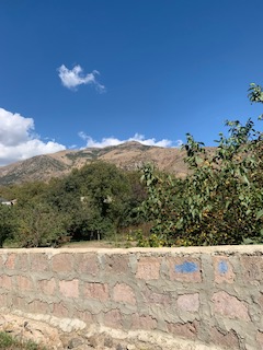
The main road offers lovely views of Bjni’s private homes nestled between overlapping mountains, mesas and the winding Hrazdan River.
You’ll pass the public mineral waterspout on the left and see grazing cows and sheep, chickens running loose as well as ducks, geese and neighborhood dogs. In about a half hour from the basecamp, you’ll inhale some glorious odors. You’re passing the Apri food factory, known for stewing and canning vegetables and marinades, preserves and jams, and syrups and juices for domestic consumption and export.
Continue on the main road for another 10 minutes until you pass a pastry shop on the right called “Sweet Home.” A block or two afterward, look for a corner building that has an address sign on it that says “No. 2.” Turn right at this corner, and walk straight up this road, bearing left to stay on the main path as the road occasionally splits. When you see a roadside property that has a silver sheet metal fence with stacks of gray slate stones piled up alongside, you’ll bear right. This will place you on the path leading to the St. Sarkis church graveyard.
The one-room church of St. Sarkis is within sight from the church graveyard. Inside this quaint structure, there are many religious icons and paintings as well as pedestals for lighting candles. Beside St. Sarkis is an intricately carved khatchkar dedicated to the church in 2019.
Sarkis was a patron saint of Christian Orthodox Churches. He was a 4th century Roman soldier who became a Christian. He rose through the military ranks because of his valiant campaign on behalf of Emperor Constantine. With the accession of Emperor Julian, Sarkis and his son took refuge in Armenia, where Christianity had already been the nation’s official religion. Later they went to Persia to join the Persian army to fight Julian. Both fought with exceptional bravery.
The Persian leader, Shapur II, tried to convince Sarkis and his son to abandon their Christian faith and embrace Zoroastrianism. Both refused, and father and son were martyred. Fourteen loyal Christian soldiers who went to claim the bodies were also killed. Eventually, Christians secured the remains and sent them to Assyria where they remained until the fifth century when Armenian patron saint Mesrob Mashdots had the remains transferred to the city of Karpi in the area of Vaspurakan in Armenia (present-day Turkey). A monastery was built over the site of the graves. The present status of that monastery is unknown.
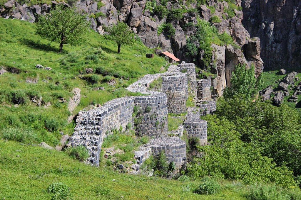
7: Bjni Fortress Hike
Walking Distance from Camp Bjni Basecamp: 40 minutes.
Excursion Duration: 2+ hours.
Level of Difficulty: Easy to Moderate.
In the time of the Bagratuni Armenian Dynasty, the hamlet of Bjni came under the domain of the royal Pahlavouni family. The Pahlavounis built this fortress atop a mesa in the 11th century. The fortress-castle served as a defensive post from assaulting Turkic nomadic tribes. Some of the Fortress walls, working secret underground passages — as well as the ruins of many structures serving various purposes — have been preserved.
The main mesa of Bjni is a broad, flat-topped elevation with one or more clifflike sides. In the 11th century, a nearby monastery was also built. This sanctuary was erected in 1031 by order of Prince Grigor Magistros. It was dedicated to Sourp Asdvadzadzin (the blessed Virgin Mary) and still stands today as a spiritual and artistic beacon for Bjni and nearby settlements. The monastic complex possesses an impressive sculpture park of khatchkars with works by reknowned stone mason Melikset Gazmogh. The site also features an artifact museum.
To access the fortress remains and museum, be prepared to pay a modest admission fee at the entrance.
Our hiking motto is:
“Leave no trace: pack it in, pack it out.”
